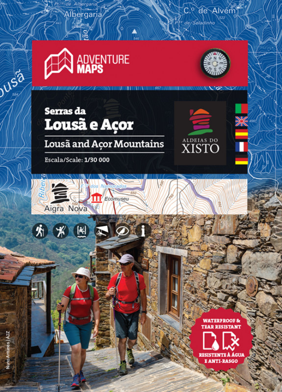
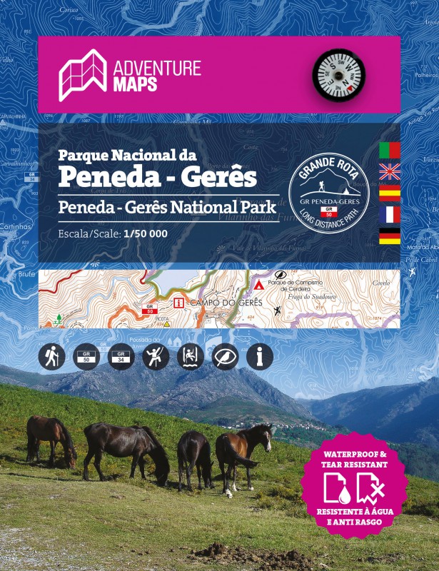


CARACTERÍSTICAS TÉCNICAS:
· Base cartográfica do CIGeoE - Centro de Informação Geoespacial do Exército
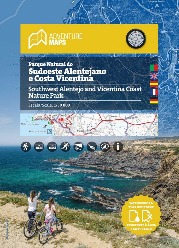
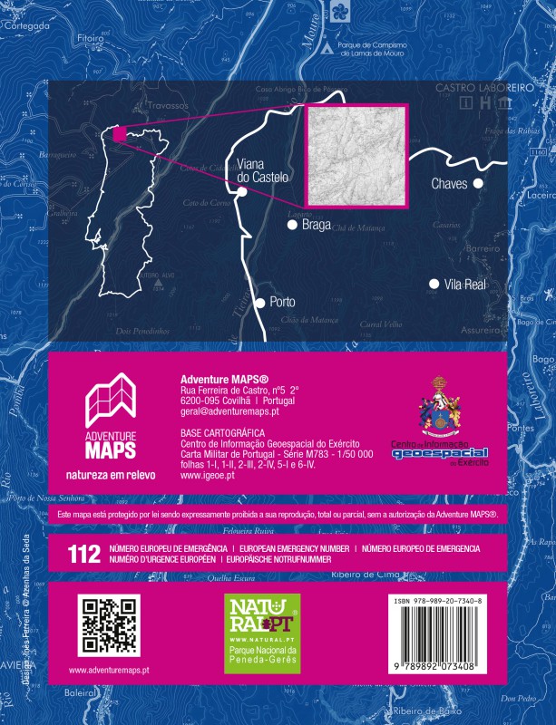
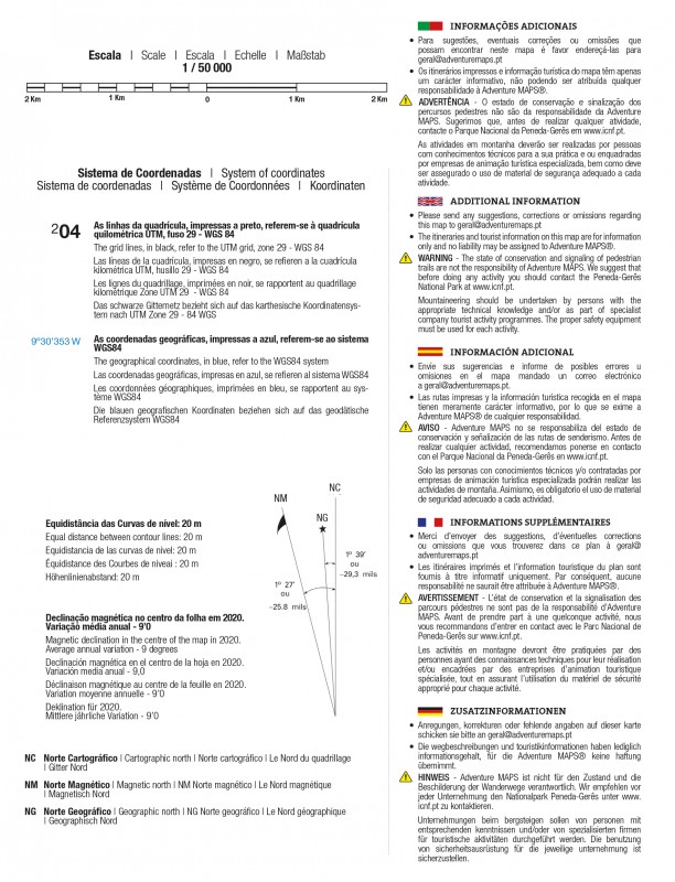
· Escala: 1/50 000 (1 cm = 500 m)
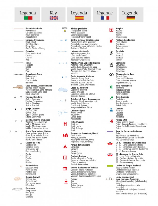
· Legenda e Informações Adicionais em Português, Inglês, Espanhol, Françês e Alemão
· Bússola magnética incorporada
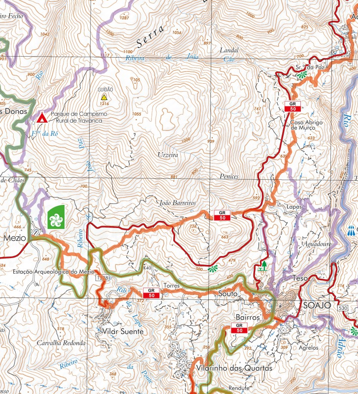
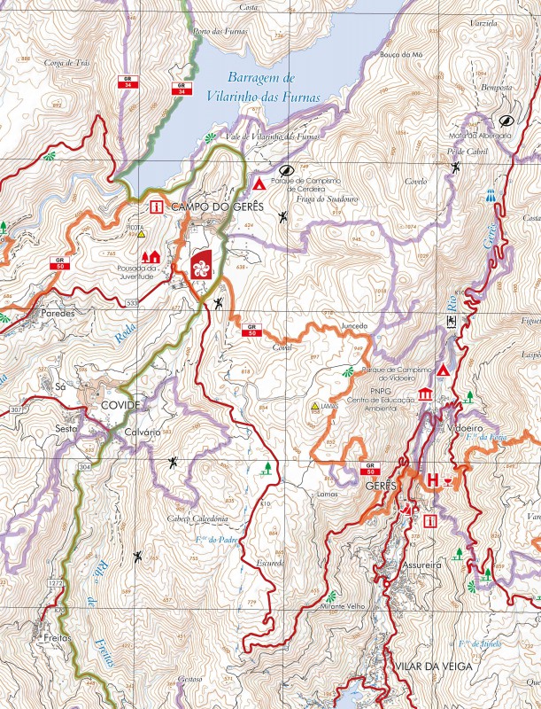
· Percursos pedestres, GR(Grande Rota) e PR(Pequena Rota), inclui GR34 e GR50
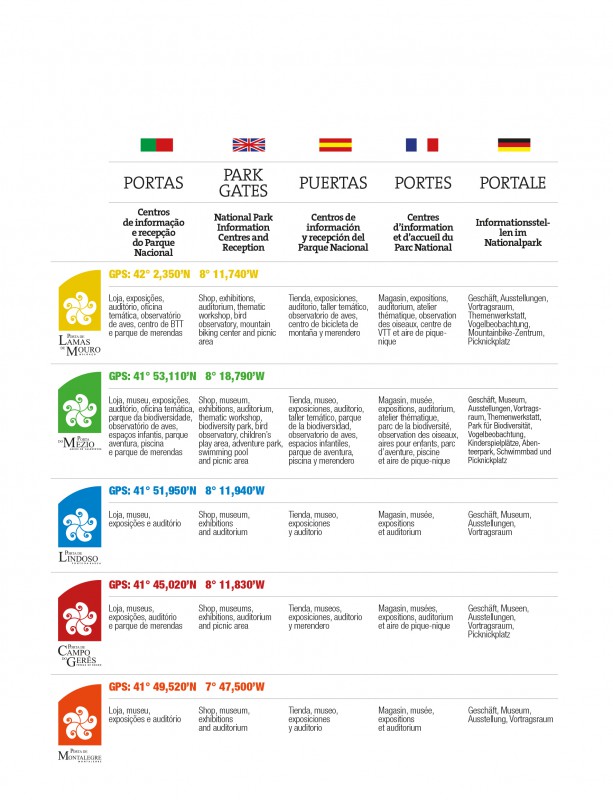
· Informação especifica das "Portas" como centros de informação e recepção do Parque Nacional
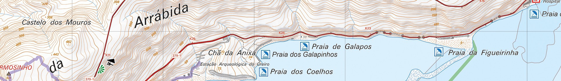
· Pontos turísticos de interesse com simbologia, Cascatas, Vistas Panorâmicas, Áreas de Picnic, Museus e Postos de Turismo, entre outros
· Spots de Escalada, Canyonig e Observação de Aves
· Equidistância das curvas de nivel: 20 m
· Quadricula UTM com divisões de 2 Km (compatível com GPS)
· Coordenadas WGS84 (compatível com GPS)
· Representação da declinação magnética
· Dimensão aberto: 96cm x 59cm
· Dimensão dobrado: 15,5cm x 19,7cm
· Impressão: frente e verso com area de sobreposição
Papel Sintético à prova d'água e anti rasgo
"O Parque Nacional da Peneda-Gerês, com 69.594,48 ha, estende-se dos planaltos da Mourela ao de Castro Laboreiro incluindo as serras da Peneda, Soajo, Amarela e Gerês. Trata-se duma região montanhosa, essencialmente granítica em cujas zonas de elevada altitude são visíveis os efeitos da última glaciação. Vales profundos e encaixados suportam uma densa rede hidrográfica que possibilita uma grande variedade de formas de vida e de vivências.
Notável diversidade botânica - bosques, matos, vegetação ripícola e turfeiras para além de matos húmidos - destacando-se a presença de várias espécies raras e endémicas. Alberga alguns dos mais importantes carvalhais de Portugal. Interessantes habitats seminaturais. Diversidade de espécies faunísticas com estatutos diferenciados: endémicas (salamandra-lusitânica); ameaçadas (lobo-ibérico, cabra-montês); de distribuição limitada (cartaxo-nortenho)... No mosaico agrícola destacam-se os prados de lima e lameiros.
Este, que é o único parque nacional em Portugal, possui ainda um rico património histórico-cultural que inclui necrópoles megalíticas, vestígios da romanização, castelos, espigueiros tradicionais com maçarocas de milho, velhos fornos, moinhos de água, levadas, socalcos, brandas (onde as populações passavam o verão), inverneiras (onde aguentavam o rude inverno), termas, tradições peculiares… A tudo isto acresce a curiosa implantação das aldeias serranas e a presença de núcleos de arquitetura tradicional bem preservados."
Texto: INSTITUTO DA CONSERVAÇÃO DA NATUREZA E DAS FLORESTAS, I.P.
Mapas,mapa peneda gerês, caminhadas no gerês,percursos pedestres, cascatas do geres